Wednesday, December 1, 2010

Saying Goodbye

This place has been home and it's going to be hard to leave. Here is a brief list of some of the things I'm going to miss:

-The mountains. They are the landscape here. They divide our quiet slice of the state from the hustle and bustle of the west side. They provide recreational opportunities during every season and they are the reason that most people live here. Some people feel insignificant in front of huge mountains. I feel protected. It reminds me that there still are wild places out there, they just have to be found.


-The lake. After all, it's the reason I came here in the first place. Because of the lake, I have become an educator. Because of the lake I have found love. Because of the lake I have challenged myself intellectually, socially, physically and emotionally. Because of the lake I've had a home here for the past 7 months.


-The people. This is a transient place. People here are generally nomadic. This is both amazing and the most tragic thing imaginable. It means that each season a whole new crop of young, energetic people arrive in town. In a town of 400 people, you never expect to find 30 people who could potentially be your best friend. That's how summer is here. But then fall comes and everyone leaves. Everyone always leaves. And then you discover that there is a whole separate community aside from the seasonal sector. There is a school here with kids and parents and all the things any other town has, just smaller. One of the best things I did here was to get involved with that side of the community. Coaching at the high school has introduced me to some of the best people and most rewarding relationships I could have hoped for.
-The solitude and quiet. You don't move to a place like this without knowing how to be alone. I'm so grateful for the good friends I've made here, but I'm also grateful that I've gotten to spend time by myself - hiking, swimming, biking, thinking - and have really begun to understand who I am and what makes me happy. I'll take the wind rustling through the Jeffrey pines and a Great Horned Own who-whooing under a spectacular array of stars on a frigid fall night over traffic and sirens and neon lights any day, even if it means I have to drive 30 minutes for the nearest cup of coffee.
-My job. I don't know how I got so lucky. Every day I get to spend time with kids teaching them the value of spending time outside. Together, we discover things they never knew about themselves and about the world. We talk about stream ecology standing ankle deep in Rush Creek. We think about the differences between a Jeffrey pine and a pinion pine with a cone from each in our hands. We discuss climate change standing in the shadow of Califonia's biggest refrigerator - the Sierras. We address real world issues while we're out there, in the real world, apart from computer screens and cell phones. My co-workers provide me with support, new ideas and many, many laughs. I have the best job in the world.

It's time to move on now, and my feelings are very mixed. My next step will take me to a new and different place, but so many of these little details will be missing. Surely I'll find many things to love about Colorado too, but for now I'll be dreaming of following a great blue heron down the Lee Vining Creek Trail, of standing on top of Glass Mountain and seeing the entire Eastern Sierra laid out in front of me, and of wandering through the tufa with Violet Green swallows darting and weaving through the air around me.

Lee Vining, Mono Basin, Eastern Sierra: I will miss you.

Thursday, November 25, 2010

Why I'm Thankful

Apparently it's trendy to make lists of why you're thankful. I've never been one to follow trends - I'm doing this simply because for me, the biggest thing is always family and friends and this year I was not with either. But don't worry, this is not going to be a whiny, you should all feel sorry for me kind of post. Rather, I hope it will be quite the opposite.

First, let me start by saying that as the years go by and especially now that I'm not in school anymore, I'm beginning to really learn and appreciate the value of family and friends. These people have made me who I am today, they continue to support me as I move forward in my own endeavors, they let me lean on them, depend on them, call them at all hours of the day (and night), ask ridiculous favors of them and give me their love. I wouldn't be who I am or where I am without them. So naturally, it was a little difficult to spend the day without any of these people. Last year, I was lucky enough to be surrounded by a great group of friends when I was stuck in a far away city. Here is a picture from our wonderful night:


And to my family, there are not enough words to explain how important you are to me. I'm so glad we've had the opportunity to travel together and visit each other even though we live in different states (and sometimes different countries). This photo was taken during the week of my college graduation:


Today, I actually had to work. I've mentioned previously that I teach environmental education to at-risk youth from Los Angeles. I've learned more about the diversity of lifestyle and experience within our own country this summer than I have in all of my previous travels throughout the US. The group we have right now is an group of high school alumni that have made an almost annual trip up to the Mono Basin for the past 7 years. They come from very different backgrounds and have very different interests now that they're a little more grown up and some are even in college, but a trip to Mono Lake is an important way for them to stay connected to one another. Some have very close knit families, some have no families at all, but this trip and this holiday was important to each and every one of them because for these five days they are surrounded by people who love them and know them better than any other people in the world. To watch their interactions, their respect and appreciation for one another, the way they crack each other up for no apparent reason (at least it's not apparent to me), they way they look up to Santiago, my boss, is absolutely inspiring. I've only known them for two days, but they have included Michael and me in every part of their tradition and are open and honest with their feelings and thoughts about this place. Rather than feeling sorry for myself today, I felt blessed to be around such kind and caring people.

-I'm thankful for my job. I get to work outside every day with kids who's eyes are opened to a whole new world beyond the city during the time their with us.
-I'm thankful for my co-workers. We've had our ups and downs this season, but at the end of the day, they are kind men who have the best interests of our team and the kids we work with at heart. They give of themselves to provide an amazing opportunity for kids who may not have a chance to experience something like this again. And they support me as I learn and come into my own as an educator.
-I'm thankful for this wonderful place that I've gotten to call home for the past 7 months. Each cardinal direction holds a different view equally beautiful and worthy of exploration.
-I'm thankful for my friends who love me even when I go for 6 months without contacting them. They make me laugh and give depth to my existence. To quote one of my kids this summer, "You're like elevator music. You make the ride more fun."
-But most of all I'm thankful for my family. To my parents who taught me curiosity and to have a sense of adventure and who understand when that takes me to Africa or Ecuador or the middle of nowhere in Colorado. And to my sister who has taught me to use my imagination. With those three tools, what else could you possibly need? I love you guys and I'm missing you today.

Tuesday, November 23, 2010

Moonlit Glides and First Turns
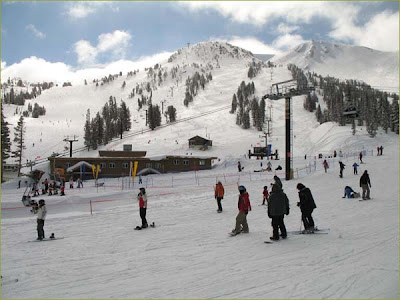
I have a love/hate relationship with the state of California. I mean, what's to love about a state that pulls money from education programs and state park funding to pay our politicians? That pulls people out of prison rather than raise taxes to balance the budget? But how can you possibly hate a place that opens its ski hills the second week of November? That has the highest mountains and the lowest valleys in the country? My relationship with California: it's complicated.

I'll be leaving this state soon so it's nice to go out on a positive note, or should I say a snowy one? I've missed real winter for the last couple years, but growing up in Montana I developed a healthy appreciation for snow and cold weather. When our forecast began calling for feet of snow last week I got ridiculously excited. I stared out the window just waiting for the clouds to begin piling up behind the Sierras, for the sky to darken and for those first feeble little flakes to begin falling. It was hard to remember what feet of snow was like. I started making all kinds of plans for the snow - skiing, sledding, skiing and more skiing. And snow it did. Between Friday night and Sunday afternoon we logged about 9 inches here in town with between 3-5 feet falling in the mountains.

The clouds finally began to clear a bit on Sunday afternoon so my housemate Julia and I took advantage of a beautiful full moon to ski out to Panum Crater. Highway 120 had not been plowed and as soon as we skated away from the car it felt like we were the only people in the world. Snow inspires an incredible stillness. It muffles the sounds of crunching gravel, snapping branches and rustling leaves, and the quiet at Panum Crater was almost deafening.

http://www.blackcatweavery.com/LakeTahoe2007.htm

The next morning, my other housemate Morgan and I left the house early to get to Mammoth Mountain in time for an 8:30 opening. The wind must have been blowing 40 mph most of the day, but that didn't stop us from getting in some early season turns. We both just purchased telemark equipment, so I was showing Morgan how to drop her knee and ski for real! The snow (that hadn't blown away) was fluffy and beautiful and we had a great day! Even met up with friend Clif for the afternoon and challenged ourselves on some steeper slopes.

Photo courtesy of http://4-mammoth-condos.com/

These Sierras have been a truly remarkable place to call home. I know I say too often and it starts to lose its meaning, but the variety of ways to play out here (and people who want to play) continue to astound me. Many thanks to all who have made this place home for the past two summers. I'll miss you and these sentinel mountains more than I can ever express.

Sunday, November 21, 2010

A compliment

"As we drove through Wyoming and Utah I thought of you, because even though it's not Colorado, for some reason you just remind me of the west :-)"

Thanks, ex-roomie!

Thursday, November 18, 2010

Perspective

I have been incredibly lucky to call Lee Vining, CA home for the last 7 months. Aside from the fact that this is one of the most beautiful places in the world, I've met some remarkably wonderful, loyal, energetic and passionate people here. In ten days I'll be packing up my entire life, loading Sebastian to the gills, and heading up north to Montana for the month of December. And I know I'll start missing it here as soon as I lose sight of the lake in my rearview mirror.

I've spent a lot of time on this blog describing the places that I've seen and the adventures I've had but I have never quite been able to elucidate exactly what it is about this place that makes me feel at home. There's a particular comfort that you achieve once you reach a certain level of familiarity with any place and to me the Mono Basin has been special because that familiarity has been reached with places that are innumerable and hidden, yet easily accessible. I think just about every person here would have a different answer for the question, "Where is your favorite place in the basin?" and for all different reasons. There are so many possibilities, but unlike the unfathomable vastness of the Sierras or even Yosemite, the Mono Basin is relatively small and each place is remarkable for its own unique detail. There are grand vistas, certainly, but that comfortable familiarity comes with being able to note the minute differences in each vista, to recognize the new perspective that each angle gives, to increase the depth of your knowledge and understanding of the place.

This weekend my housemate Morgan and I made the trek up to the top of the Mono Craters, a place neither of us had been.


The Mono Craters are the youngest mountain range in North America and they run on a north-south trajectory almost into the south shore of Mono Lake. They also happen to fall in the rain shadow created by the San Joaquin gap, so the east side of the craters are covered in Jeffrey pines, the edge of the largest single stand Jeffrey pine forest in the world.


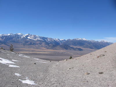
The trek to the top of the craters is a steep slog through very loose pumice sand which is quite the workout for the calves/quads/glutes/lungs, but the view from the top is absolutely worth the pain. A friend mentioned to me this summer that it is nearly impossible to see every piece of the lakeshore at any given place. Mono Lake is generally round, but has several little contours that keep parts of it hidden from most vantage points. The only place I've been that has an almost complete view is Warren Bench, though you're missing sections of the western shore that are almost immediately below you. The view from the Mono Craters is so close to complete that it makes you wish that second to last volcano hadn't erupted 1200 years ago. The only sad thing is that the lake is too big for my camera to fit in one frame. Here is the western shore.


From the top, you can see June Lake and Grant Lake Reservoir at the same time, something that I had never really thought was possible considering that they are at either end of a very narrow horseshoe loop with a mountain in between them. It also offers you a spectacular view of Pumice Flat and the Sierras. Sometimes living directly underneath these mountains, we forget how spectacular they are. This view reminded me that though the Sierras are the cause for our sun disappearing at 3:30 everyday, we are quite lucky that this is the view out our back window, not some freeway or industrial complex.


The top of the craters kind of looks like a moonscape with strangely shaped and colored rocks strewn over a surface of pumice sand. Additionally, there are large chunks of shattered obsidian lying around. It almost feels like the volcano erupted last week, not 1500 years ago. It's no wonder that the Kuzedika's chose this place as their home - the stockpile for arrowheads and spear points was inexhaustible.


I was glad to finally make it to the top of the craters. It's a great vantage point for most of the basin, and helps shed new light on the relationships between all these places I've visited countless times this summer while teaching my students the natural history of the basin. I highly recommend a trek to the top of the craters for any Monophile who is interested in a new perspective.

I'm coming to the end of my stay in the Sierra's. It's been a great run and I've enjoyed every moment of my time here. I'll be sad to leave this home place, but eager to explore and develop a new one when I move to Colorado in January.

Monday, November 15, 2010

Hiking Barefoot

Fall is quickly turning to winter here in the Mono Basin. All the aspen have lost their leaves and frost coats the grass each morning. It's getting cold at night and we've been lighting a fire in the wood stove almost every evening to keep the house cozy. I love fall, but more than fall, I love seasons. I love the change. I love the anticipation of waiting for snow on a frigid, cloudy evening and knowing that after four months of glorious skiing spring will come again.

That said, I also love being able to escape to places where I can hike year-round, regardless of the weather at home. Death Valley is one of the places. I took a long weekend last weekend and headed South to visit the lowest point in the United States, at least that's what I thought I was visiting.

It turns out that Death Valley is MUCH more than just the lowest point in the United States. It's a series of mountain ranges with seemingly desolate valleys between, hot springs, beautiful slots canyons, glowing golden sand dunes, thunderstorms, endemic species, and a huge range of diversity that is very different from what my mountain upbringing had prepared me for. The days I spent in Death Valley were refreshing, educational and definitely enjoyable. Here is a sneak peak of what I did.

The first night I arrived after dark and set up my tent without really knowing where I was. I had arrived at the parking area for the Eureka Dunes, but I had no idea where they were, how big they were, or what they looked like. When I awoke the next morning, this is the view I had out of my tent:

I spent the morning exploring the dunes - trekking up the steep ascents as waves of sand cascaded down and between my toes (I learned early on that it's actually much easier to hike barefoot) and slide/skiing down in mini avalanches. I watched little beetles paddling their way through the great sea of sand and leaving little scuttle-mark trails behind them.

I saw the individual grains dance when the wind kicked up. But above all, my favorite thing was the play of light on the ridges of the dunes. I began hiking around 8 am so the sun was still pretty low in the east and I got to see every little impression highlighted and cast in shadow as the sun moved across the sky. It was incredibly beautiful.

An interesting thing about Death Valley is that the entire northern section is connected by dirt roads. That part of the park was annexed sometime in the 1990's, so it's relatively new to the Park Service and for whatever reason, they've decided to leave the roads undeveloped. This makes for pretty slow going as many of them are deeply rutted with washboard. I spent several hours that afternoon making my way to the central part of the park and on the way stopped at Scotty's Castle and the Ubehebe Crater.

Scotty's Castle is pretty bizarre. A narrow highway winds through a desert canyon and suddenly opens onto the Scotty's Castle grounds - palm trees, a small stream and a castle that looks like it came straight off an Italian vineyard. It was built by a millionaire for his friend and Death Valley prospector Scotty Johnson in the 1930's. It's a beautiful castle but seems somehow out of place in the desolation of Death Valley.

Ubehebe Crater is equally bizarre. The road takes you right to the rim of the crater and there in front of you is a 700 foot hole, as though someone has taken a gigantic ice cream scoop out of the earth. It is vibrantly colored in orange striations and is of volcanic origin.

I spent the night at the campground in Stovepipe Wells and weathered an impressive wind/rain storm that had my tent whipping and drumming all night long.

The next morning I headed back north and into the Grapevine Mountains. I hiked up and around a large alluvial fan and into Fall Canyon, one of the most beautiful slot canyons I've seen. The path was paved with small round rocks and the walls were striated and colorful.

I was completely alone and the only sound I could hear was the occasional plane flying overhead. The difference between a Death Valley slot canyon and a slot canyon in Southern Utah is that the canyons in Death Valley are actually in mountain ranges. This means that they're really steep. In Utah the canyons are a lot more gentle so that even though you are hiking uphill, it feels relatively flat. Fall Canyon was steep and the loose gravel of the trail made for quite the calf workout. A couple miles us the canyon you run into the fall - basically a wall of smooth marble that is about 18 feet tall. I brought my climbing shoes, but did not feel comfortable climbing without a spotter; this was the end of my hike.


That evening I went to Salt Creek, a sink in Death Valley proper that is about 262 feet below sea level, only about 20 feet higher than the lowest point in the US. Salt Creek is cool because it is entirely colonized by a plant called pickleweed that has special salt and heat resistant adaptation.


Salt Creek is also home to the endemic Death Valley pupfish. It's hard to imagine anything living in the hyper-saline water of Salt Creek that recedes to almost nothing in the summertime. Nonetheless, these pupfish persist year after year in the little water available in such a harsh environment. Unfortunately, I didn't get to see any pupfish because they had all followed the water upstream to little pools that remain even in the heat of summer. I did, however, get to see Salt Creek begin it's annual rewatering. Both nights that I camped in Stovepipe Wells it rained which was enough to get Salt Creek flowing back downstream. I was there right at sunset and it was incredibly beautiful.

My last day in Death Valley I woke up to more rain. I ran up to Mosaic Canyon because I figured most other people wouldn't be hiking up a slot canyon in a rain storm and I was right! Again, I had the whole place to myself. Mosaic canyon is so named because of the interesting conglomerate that forms the western wall of the canyon. It is basically cement with chunks of marble stuck in it creating a beautiful, natural mosaic.

It was amazing in the rain because the moisture brought out even deeper colors in the rock. This canyon also had a fall - about 30 feet tall this time - but the trail bypassed it through a series of climbs and traverses on the canyon wall. It was a very satisfying hike and I think the narrows in this canyon were the best I've seen.

On the way home I made a stop at Darwin Falls, a total anomaly in the midst of the dry desert scrub and sand. Darwin Falls is set a couple miles back in Darwin Canyon and is absolutely unexpected. The hike takes you up a gravel strewn wash among mesquite trees and russian thistle, but suddenly you come around a corner and there are willows and cottonwoods. Hike a little farther and you can see ferns and other water plants growing right in the little creek. The trail winds back along a rock wall of a gorgeous little falls that empties into a small pool back in a creviced corner of the canyon. What a refreshing way to end a weekend in the desert!

Death Valley is strange. There's really no other word for it. It's not what you expect at all and ecologically speaking, it's more diverse than you can imagine. Inside the park, the elevation varies from -282 to over 11,000 feet. The country is incredibly wild and much of the park is under visited. These few days that I got to explore only whetted my appetite for many future Death Valley trips.

Friday, October 1, 2010

More visitors!

It's so fun to live in a place that people want to visit. Yosemite, the Sierras, Mammoth, Mono Lake - climbing, hiking, camping, canoeing, biking - it's a place for everyone. This summer, our little house has been bursting with visitors from the beginning of July until now.

This last visit was particularly special. Some great friends that I haven't seen in a long time made the trek from WA/OR to stay for a few days and play with me. Emily and Brett are friends from college that graduated a few years earlier than I did. We saw each other here and there after they finished school, but it's been a couple years now since we've all been in the same place. They came for a couple days of hiking, swimming, climbing, etc. It's always fun to have visitors because I get to show them the places here that are special to me and that make this place somewhere I really love to live. I took Emily and Brett up to Lundy Canyon on the hunt for some fall color and to show off the awesome work of the Lundy beavers. Fall seems to be taking it's time this year, so while some of the trees are beginning to turn a burnished gold sort of color, we don't yet have any of the brilliant oranges or reds. But a hike up Lundy is always enjoyable, and the beavers never fail to impress with their amazing feats of engineering.


That afternoon we went to the rope swing at Gull Lake to take advantage of some of the last warm afternoons of the season. By the time we got there, the sun had already disappeared for the day, but we still took the plunge into the chilly water.


It took a bit of convincing and some serious pep talks, but there's nothing more invigorating than submerging yourself in a cold mountain lake on the last day of September and once we were in, we were glad to have jumped.

Then we drove to Minaret Vista for the sunset which was absolutely spectacular. The San Joaquin River Valley glowed as the sun lit the sky on fire. The Minarets provide a dramatic backdrop with their rugged toothlike shape. The glowing orange you see in the picture is smoke from the Sheep Fire in Sequoia National Park. Generally we haven't had too much smoke this summer (other than when the craters were on fire) but on days when the wind blows a certain direction we pick up a bit from this fire which has been burning for over 2 months now. Makes for a nice sunset at least.


We concluded the night with a dip in the hot springs outside of Mammoth. The moon has been rising pretty late so we had a sky full of stars to admire as we soaked. Overall, a wonderful day with great friends. Thanks for visiting, guys!

Friday, September 24, 2010

Big Changes

Wow, so epic fail on the blogging for the summer. I think that's mostly because I did very few of the things I was planning on blogging about. I stopped running in June and stopped hiking a few weeks ago because of a knee injury. So while the blogging was a failure, the summer itself was not. I had a wonderful second summer in Lee Vining and am so very grateful for the fantastic friends I made and the great times we had. I know that's vague, but if you're out there reading this, you know who you are and what I'm talking about.

The next two months are mine. Things have really slowed down in Lee Vining - many of the seasonal employees have headed home along with the majority of the tourists. My job continues until the end of November, so that means I get to live in this place as a pseudo-local for the next couple months. And the list of things I have to accomplish is long.

I want to start running again. It was such an enjoyable pastime while I was doing it earlier in the summer - a great way to have an hour or so to myself each day. As the days begin to cool down, it increases the number of hours I have to run. Additionally, I'm coming off a torn MCL - a great story, though one I'm not going to share on the internet, if you don't already know ask me - so it'll be slow going to start. But I'd like to get back into the routine, and the new half marathon date is for sometime before next August. I know that gives me WAAAAAAY too much time to train, but I have no idea what my life is going to be like after November. I'll get to that in a minute.

The list also includes a lot of hikes to places I haven't yet visited. I'm focusing mostly on areas within the Mono Basin for the next two months because...here it comes...after November I'm leaving. I'll go home for a month, then come January, I'll be headed off on a new adventure - both eerily similar and completely different from the life I've been living here in Lee Vining. I've accepted a job on a ranch in Western Colorado for the year to work with a close friend designing an education program that will involve working with kids from surrounding communities. The ranch community is very small and the work is similar to what I've been doing here, but the Western slope of Colorado is a completely different landscape from where I've been living. I'm excited about the opportunity and the challenge, but I'm not looking forward to the leaving.

Throughout the summer I steadily grew to love and appreciate this place even more than I did last year, more than I thought possible. As I became more and more at home here, I began to look for opportunities to stick around (semi?)permanently. For those of you who know me well, you know how big of a deal that is for me. I haven't live anywhere longer than 6 consecutive months since I left home for college at 18. But something about this place has really grabbed me - could be the incredible landscape, but it also has something to do with the quality of the people here. I've made some of the best friends of my life in this place and that will be very hard to leave. It's difficult to describe to someone who's never been here exactly what it's like to live in a place like this. I feel like my sentences are full of hyperbole and lack any real quality or meaning that can be grasped from an outsider's perspective. I suppose that sounds kind of condescending and that's not how it's meant. It's just difficult to explain the little moments that make up living in a town of 400 people on the side of some of the most incredible mountains and wild places our country has to offer. So the next two months I want to spend exploring those nooks and crannies that somehow, over the 9 months that I've been here, have escaped me. I know there are way more than I can possibly discover in that much time, but it'll leave me something to come back to someday. And I do plan to come back. I love it here too much to leave forever so soon.

Mono Lake from Warren Bench 9/22/10

Tuesday, August 3, 2010

My parents came to visit!

Hence the lack of blogging...I'm trying to catch up now.

First, let me introduce my parents:


Sorry guys, I know you like anonymity, but I don't actually know if anyone other than you guys read this, so I think you're safe. My parents live in Montana where I grew up. They were the ones who taught me to love and appreciate mountains in the first place, so it's really fun when they come visit me in the Sierras. The mountains here are just a little bit more of everything than the mountains in Montana: a little steeper, a little more rugged, a little (well, actually a lot) higher. My parents are currently in training for a pretty epic 14-day trek through the Alps for their 35th anniversary (!!!) so it was great for them to come to the Sierra's and get some practice hiking steep mountains at higher elevation.

Our first hike took us up Lundy Canyon, over the crest, through the Twenty Lakes Basin and out at Saddlebag Lake. This hike is incredible diverse and satisfying, though there is one section that is a little treacherous. Because of this, I would probably only take this hike from Lundy to Saddlebag, not the other direction.

Lundy Canyon is one of the jewels of our area. It's steep walls are vibrantly colored with different kinds of rock interspersed here and there with aspen groves, white bark pine stands, occasional juniper trees and lush meadows full of gorgeous wildflowers. This year we've had mariposa lilies, sierra lilies, larkspur, indian paintbrush, mountain pride and many many more. There is an active colony of beavers that are constantly recreating the landscape, damming Mill Creek in different places to create new ponds, moving their lodges from one area to another, and generally re-engineering the place so that it seems like it's never the same from day to day.


Busy beaver hard at work

This hike starts at the Lundy Canyon trailhead and the first three miles follow Mill Creek up the canyon. The climbing is generally pretty gentle with a few steeper pushes that are well masked by the beautiful scenery alongside the trail - a waterfall, a gorgeous beaver pond, some really neat geology, etc. After about 2.5 miles, you reach a long, cascading waterfall that marks the end of the canyon. From here, the only way to go is up. A beautiful waterfall descends from the southwestern edge of the canyon and the trail switchbacks up alongside it for awhile before it's lost in a slope of scree that, according to summitpost.com "has not yet reached its angle of repose." That is the most apt description I can think of. You fight your way up in a two steps forward, one and a half steps back manner that is both tiring and frustrating. It also has the potential to be dangerous to any hikers below you so it's important that you keep an eye out for sliding rock.

The steepest scree slope of all time (not really, but it felt like it)

Once you reach the top, the view is incredible. You've crested in the Twenty Lakes basin, a gorgeous basin surrounded by huge, jagged mountains whose names I do not know. Lake Helen is the first lake you pass, and its sparkling cobalt waters look so inviting! We didn't have time to swim, but I can only imagine how cold the water was.

Lake Helen with some beautiful mountains in the background

The rest of this hike is very mellow. You climb up and over a saddle and through the lakes basin passing by a few more lakes on the way to Saddlebag. Once you reach Saddlebag you have the option of taking the water taxi across the lake and to the parking lot, or you can walk around either side of the lake. We chose to walk along the east side because the trail on the west side was still partially covered in snow, but the east side trail is probably about 3/4 mile longer (though you can't tell at the start).

This hike is really beautiful. I definitely recommend doing it and even considering camping overnight in the Twenty Lakes Basin. The only downside to this hike is the shuttle. One car is left at the Saddlebag Lake parking area, most of the way up Tioga Pass. This drive is beautiful but it's slow moving and if you're lucky enough to catch it during road construction (which my parents and I did) it takes FOREVER. At least it felt like it. The other car is left at the Lundy Canyon trailhead, about 7 miles north of town on 395 and then 7 more miles up the Lundy Canyon road. It takes almost an hour each direction. However, all that aside, this hike is definitely worth taking!


Tuesday, July 13, 2010

Glass Mountain 7-12-10

I've been doing a lot of solo hiking lately. For me, hiking solo is both a challenge and a luxury. Simply put, I can push myself as hard as I want and take breaks whenever I want, but I don't get to share the beauty of the places I'm seeing with anyone else - except all y'all out there in cyber-world. The other great part about solo hiking is that it takes little-to-no planning. If I want a lazy morning and then decide to hike around 1:30, no problem. I'm the only one to blame if I end up missing dinner because I left too late. I pack my backpack the same if I'm hiking 6 miles or 16 miles, so even if I hop in the car planning to go one place and getting side tracked by another, it's no problem.

My latest adventure took me up to the summit of Glass Mountain which is, according to my boss, "one of the most obscure peaks in the Mono Basin." I've been wanting to do this climb for awhile for several reasons. When you live in a place like Lee Vining, it's really easy to get seduced by the grandiosity of the Sierras and forget that the landscape extends out in all directions. Glass Mountain sits out on the edge of the basin between the Whites and the Sierras, slightly north of Crowley and south of the Adobe Valley and has an incredible view for miles and miles. I'm also curious of all the things that exist east of me, because I haven't spent much time out there, even in the Whites. Finally, Glass Mountain is one of the simplest mountains to climb around here. There isn't much of an approach, yet you still reach just over 11,000 ft.


Some kind of buckwheat hugging an obsidian edge

Glass Mountain is on the northern edge of the Long Valley Caldera, one of the biggest calderas in the country, that erupted around 760,000 years ago. Glass Mountain itself is a gigantic volcano that went through a series of eruptions between 2.1 and .8 million years ago. To this day, the mountain is covered in broken chunks of obsidian and pumice that form a patchwork across the slopes. As one of the witty entries in the registry said, "I've never hiked a trail strewn with so much broken glass."


The "getting there" is the hardest part of this hike. There are at least a hundred dirt roads that criss-cross this section of Mono County (I NEVER exaggerate) so not only do you have to find the right one to take off of 120 East, but then you have to make all the right turns (marked and unmarked) to get to the little two track four-wheel drive road that eventually peters out into a little footpath that will eventually take you straight up the side of the mountain. From what I've read, there are multiple ways to ascend Glass Mountain. You can hike straight from Sawmill Meadows, a really beautiful, remote campground that is mostly abandoned, from the north somewhere around Crooked Meadow, from the west (which looks and sounds like death) or from my little two-track. This route appears to be the simplest, most straightforward route up. The key word here is UP. My guess is that the "trailhead" starts around 9400 ft and takes you almost straight uphill to the summit of the mountain. There are a few meanders here and there along the trail, not even big enough to call them switchbacks, but for the most part you are walking uphill through pumice sand.

Initially you pass through a wooded area, lots of aspen that collect near the seeps and springs in small valleys, and tall, puzzled barked Jeffrey's that eventually give way to white bark pine as you begin to climb. The white bark pines take on krumholtz characteristics once you pass about 10,500 feet, so the view becomes clearer and more accessible as the trees become shrubby. Eventually you crest the ridge leading to the summit. From this vantage point, you can see Crowley and have an amazing view of the Long Valley Caldera. The Minarets peak over the ridge and inch into view the higher you climb.

View of Crowley and the Sierras from the top

View of Mono from the top

Once you reach the top, the 360 degree panorama is amazing. You stand on the highest point between Long Valley and the Mono Basin and can see for miles to the north and south. A summit register chronicles the highs and lows of others journeys to the top. I summited on July 12th, but there hadn't been an entry since June 26th. What a remote spot! I highly recommend this hike to anyone looking for a quiet, beautiful area. The hike is challenging but very short, and the view is worth the burn in your quads.


View of Glass Mountain from Hwy 120


Friday, July 2, 2010

A few days ago I took on an epic adventure and hiked the 19 mile round-trip trek to Waterwheel Falls. These falls are one of those kind of mythic, storied places in Yosemite National Park that many people talk about, some have actually been to, and few have seen during peak flow. I now am one of the lucky few. It's a hike I've been thinking about for a long time now, something I had hoped to do last summer but the peak flow came early and my hiking confidence came late. This year was a completely different story. Tioga Pass didn't even open until June 5th this year and though it has now been open for almost a month much of the high country is still completely snowed in. However, because you're hiking downhill to Waterwheel Falls, it opened up a bit earlier than many of the other hikes out of the meadow. However, my confidence still wasn't all there - I was nervous about taking this long of a hike, especially one I was pretty unfamiliar with, by myself. As a result, I left relatively early - I was on the trail by 8:15 - and I hustled my way down.

The hike to Waterwheel Falls begins in Tuolumne Meadows either at the Visitor Center or at the trailhead to Dog Lake. I'm not sure which one is shorter. I took the Dog Lake trailhead route because I was a little wary of the mosquitos, though I think it would have been more beautiful to hike across the meadow from the visitor center.

The first five miles are relatively flat - a nice jaunt through an alpine meadow along the Tuolumne River. There are about five stream crossings, four of them wadable with waterproof boots. The first crossing is kind of tricky - it's doable over a log a few hundred yards upstream, but then you're stuck on an island and still have to find your way across the other channel while keeping your feet dry. I would probably recommend bringing Chacos or some other kind of water shoe because in addition to the stream crossings, there's about an eighth of a mile section of trail that is a complete lake this time of year. That comes later on. The Tuolumne River is relatively flat and mellow during this section of trail, and there are many places to pop off the trail and take a dip. Because I was in a bit of a hurry, I didn't do this though I saw many people who did and it looked heavenly.


At around mile 5 the trail takes a pretty steep drop down along Tuolumne Falls. If you don't have enough time to hike all the way to Waterwheel Falls, I would still recommend coming this far. The trail isn't phenomenal but Tuolumne Falls is spectacular - it's your quintessential waterfall with layers of rock creating a chute that forces the water together and thunders down a two-tiered drop into a large pool below. Again, because I was nervous about time I didn't linger too long here on the way down.


At this point, the trail branches into three. You can either continue on toward Virginia Canyon following just below the Tioga Crest, you can stop to camp at Glen Aulin, one of the High Sierra Camps, or you continue down the Grand Canyon of the Tuolumne towards Waterwheels Falls. The signs say it's 3.3 miles beyond Glen Aulin and on the way down it feels like a mile and a half. You're walking next to a series of falls and cascades - White Falls, California Falls, and LeConte Falls all line the trail and you get pretty good looks at them as you walk. Somewhere between White Falls and California Falls is the swampy trail section I mentioned previously. It's directly below a beautiful cascade that flows down the granite on the North side of the trail and all the water collects in a meadow that's criss-crossed with deadfall. It's possible to log-hop your way across this section as long as you're comfortable with getting up close and personal with the Lodgepole Pine saplings that are beginning to recolonize the area. I found myself swinging, Tarzan-like, between saplings to reach the various logs that I could then precariously shuffle across until I could grab hold of the next young tree. This part of the trail is probably navigated much more easily simply by bringing along a pair of water shoes. After this point, you begin a steep descent towards LeConte and Waterwheel Falls.

At this point I had been hiking for about 2.75 hours and was pretty tired and hungry. I was initially a little fooled by LeConte Falls, maybe I was just being optimistic about how far I'd already hiked, and thought it was Waterwheel Falls. I was really disappointed. That's not to say that LeConte isn't beautiful, but it certainly doesn't live up to the hype of Waterwheel. Because of that, I figured I'd keep hiking just to make sure I wasn't missing something down below. The Tuolumne at this point is hardly a river. It's more like a series of cascades because the grade is so steep and as soon as I got to a better vantage point where I could see a little way down the trail I knew that all the excitement was coming up ahead. Even before I could see the falls themselves, I could see the mist and whitewater rising up from the crashing water. As I crested the rise, the falls extended themselves below and before me. With such high water, it was an amazing site. I would definitely recommend hiking down the last 400 or so feet to get to the bottom of the falls because they are difficult to see from the trail and the view isn't as impressive from above or alongside.

I reached the bottom of the falls by 11:15 and was the first day-hiker of the day to set up shop near the falls. I got a prime perch right across from the two waterwheels. Aside from the absolute beauty and awesomeness of seeing so much water crashing by, to me one of the most incredible things was the sound. These are noisy falls to be sure so that even if people had been hiking along the trail a few hundred yards away, I would not have heard them.


Having never seen this area when there wasn't tons of water gushing down it, I'm not totally sure what the rocks underneath look like. But because of the way the water acts, I'm guessing that there are huge divots and ledges that stop the flow and force it up and over. Then wind takes over and blows the water back onto itself creating a waterwheel-like rotation. I sat to write in my journal a bit and wrote these words - I wonder why people are so enthralled with waterfalls. Could it be that they serve as a rare glimpse of a power larger than us, a force exerted to a much greater and more beautiful degree? I think that could be. All the time we hear about the remarkable power of the forces of nature - glaciers, water over time, wind - but waterfalls somehow encapsulate that power. I've never been to a waterfall that didn't make my heart race, make me catch my breath and smile. The pure, unadulterated power and noise of waterfalls somehow inspires both awe and fear in me every time I am near one.


Nine miles in and totally rejuvenated by the light mist and churning water, I packed up my backpack and headed back toward Tuolumne Meadows. I ate a delicious lunch of peanut butter and Nutella, an apple and some almonds when I reached Tuolumne Falls and made it back to my car by 4:15. Eight hours and 19 miles later I was both exhausted and exhilarated by my experience at Waterwheel Falls. It's a difficult hike, but one that I highly recommend doing while the water is high.

Tuesday, June 1, 2010

Ski Until July 4!

That's Mammoth Mountain's mantra this year. Hey Montana folk - can you believe it? A bunch of us had the day off yesterday and decided to head up to the mountain and see how the snow is this late in the season. It was a funny conglomeration of people, gear, free tickets, etc and it took us a little while to get settled in. We had two alpine skiers (my roommate and a guy who lives across the street), a snowboarder (the guys roommate) and a tele skier (me). It was a pretty perfect combination though, because we were all equally intermediate at our respective mode of travel, so a lot of the day was spent perfecting turns, getting comfortable traveling at higher speeds and settling into skiing again. I hadn't donned skis at all since my knee surgery in September, so for me yesterday was a huge success! I had no pain at all and felt very comfortable lowering myself into (far from perfect) tele-turning posture.

Mammoth got several inches of new snow on Friday. One of the guys that rode a lift up with us even called it a powder day! Yesterday, though, it was almost 60 degrees. People flew by us in bright pink and yellow spandex, jean shorts, tank tops, and one guy even donned a straw cowboy hat. He must have had a chin strap to keep it on! At the lodges, the mountain had provided pool lounge chairs, and many people sunbathed during their lunch break including a group of 5 guys who spent most of the afternoon shirtless and unconscious, lounging in the high mountain sunlight. It was quite a spectacle.

We ate lunch outside in our shirt sleeves and marveled, once again, at the supreme grandeur of this beautiful place we get to call home. Mammoth lies about 30 miles south of Lee Vining, but from the top of the highest lifts you can see Mono Lake, the White Mountains, the Minarets, the beginning of the high Sierra and the Southern part of Yosemite. It was pretty spectacular.

On one of our last runs of the day, we saw a lady bug, a stink bug, and a poor confused mole all running around on top of the snow. These warm temperatures are even fooling the animals into thinking it's springtime. Maybe, finally, we'll see the sun for good!

Wednesday, May 26, 2010

Runner's High

I woke up this morning after bouldering all day yesterday with lots of sore muscles, particularly those in my upper body. Even though I've been trying to work on my pushups, my triceps and lats were really tight and worn out. Originally I had planned to go on a bike ride today because I've only gotten out on it once since I've been here. But I checked the forecast and the wind has been gusting up to 40 miles/hour out on the east side of 120, the same gust speed as the last time I went on a ride, so that discouraged me a bit. I haven't been out on a run since my disastrous attempt at 4 miles last week, so I figured I would just go out for a jog and see how it went.

I drove out to Grant Lake Reservoir, a beautiful cerulean blue lake nestled up against Mt. Wood on the June Lake Loop. The highway skirts the west side of the lake, but a small dirt fisherman's road runs along the east side for a couple of miles until it runs into a series of cliffs. I parked at the beginning of this road and began my run. I hadn't eaten much in the morning, but my stomach was feeling a little unsettled as I started out. I was nervous that this, not shortness of breath or tired muscles, might cut my run short. But it felt good to have the dirt road passing quickly under my advancing stride and as I began to fall into the routine of a run, fully engrossed both in my surroundings - a wall of 12,000 foot peaks to my right and a glacial moraine to my left - and the latest This American Life podcast, I forgot all about my upset stomach and just began to enjoy my run.

I was really careful this time to pick a route that wasn't too hilly. I know that eventually I'll have to work that into my training, but right now at the beginning, it's a little too discouraging when I feel like I need all the success I can get. This route was really nice - it followed a pretty consistent contour around the east side of the lake with only one or two small hills to put a little burn in my legs. However, what I hadn't taken into account was the wind. Silly, I know because the whole reason I was running instead of biking was wind, but I thought I would be protected tucked up against the moraine. Wrong. The whole way out, a strong head wind was whistling in my ears, making my podcast difficult to ear, and making my eyes water. Again, I was a little apprehensive, but it turned out ok. It actually felt like someone was pumping air down my lungs and it meant that I got to run in the sun without overheating. It was pretty fun! I got a little more than two miles out and turned around to make my return journey. At this point I started feeling a little fatigued, not too out of breath, just a little tightening in my glutes and hamstrings. I was a little nervous, but wanted to keep running just to see if I could do the 4 miles.

My run back was fantastic. I started taking longer strides with the wind at my back and felt like I was flying. At about the halfway point, my feet started to tingle and I got a little light headed. I wasn't really sure what was going on, but I wanted to keep running. Then I got butterflies in my stomach and suddenly I wasn't breathing hard anymore. My body was still moving at the same pace, but it was like I wasn't having to try at all, the wind and the endorphins carried me along. This was the first time I had ever experienced the "runner's high," something my ex-marathoner mom has told me about since the first time I ran three miles during track try-outs my freshman year. I always thought it was kind of a myth that runner's talked about because they're doing things that most other people don't enjoy doing, but now I know that it's a real thing and that unless I run at least 4 miles, I won't get to experience it again. How's that for motivation?

4.16 mi/41 min